Maintaining a delicate balance for one of the world’s most important shipping routes
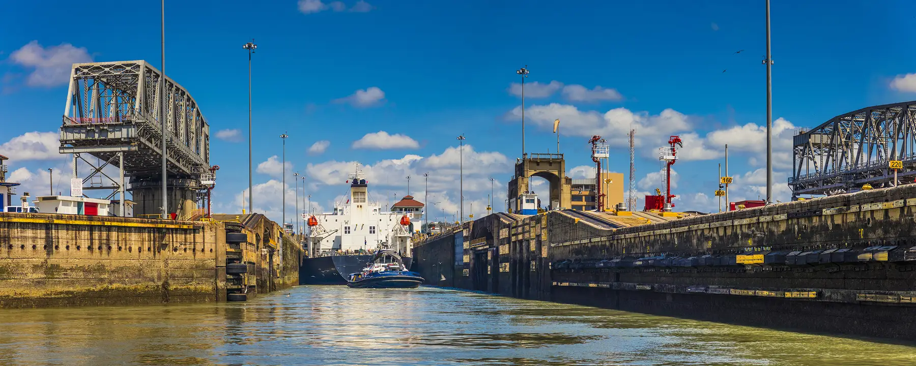
Every time a ship traverses the Panama Canal, about 50 million gallons of water has to be poured into the Canal’s locks—the three-stage system that gradually raises ships for their 50-mile journey across the Panamanian isthmus. And where does this water come from? From Lake Gatún, a 164-square-mile body of water located 88 feet above sea level, and the 20-square-mile Lake Madden, located 250 feet above sea level. Both of these lakes were formed by the damming of the Chagres River early in the 20th century, when the Canal was built.
After ships have been raised to the height of the Canal, the fresh water in the locks is discharged into the ocean—the Pacific, on one end of the Canal, and the Atlantic, on the other end. Given that an average of 40 ships traverse the canal every day, that represents upwards of two billion gallons of water—which may sound like a lot, until you remember that this is the amount of water that would have been discharged naturally by the Chagres River before the Canal’s dams were built.
As you can imagine, the smooth functioning of the Panama Canal depends on close monitoring of the water levels in Lake Gatún and Lake Madden. In the case of Lake Gatun, if the water level drops below 79 feet, the canal must restrict its maximum allowable draft, meaning ships are required to pass with less cargo. The Panama Canal has traditionally dealt with such a situation seasonally in order to keep traffic flowing.
Riverside Technology, which RTI acquired in 2017, has been deeply involved in the day-to-day functioning of the Panama Canal’s reservoir system for the past 20 years. We create, maintain, update, and train employees in the use of the software and sensor systems that measure and anticipate the water levels in Lake Gatún and Lake Madden. This enables the Canal’s managers to more efficiently schedule the passage of maritime traffic.
Forecasting Water Levels in Gatún and Madden Lakes
In 1996, we began working with the Autoridad del Canal de Panamá (ACP), the agency that oversees the water levels of Lakes Gatun and Madden and provides municipal water and hydropower (via the Chagres dams) to Panamanian citizens. Specifically, we adapted the widely used National Weather Service (NWS) River Forecast System to create the Panama Canal River Forecast System (PANFCST), which predicts river flow and reservoir levels in Lakes Gatún and Madden.
Under the system we implemented, Panama Canal engineers collect and analyze precipitation, streamflow, evaporation, and reservoir operation data, which are then used to calibrate hydrologic and hydraulic models within PANFCST to provide timely information about current and future reservoir inflows. With this information in hand, forecasters can make better decisions regarding reservoir operations and water conservation during the dry season, which lasts from December to April.
Our water simulation and monitoring operations don’t only impact the day-to-day functioning of the Canal. Millions of people in the Canal zone get their drinking water from Lakes Gatún and Madden, and Madden and Gatún Dams are also significant sources of hydroelectric power. We factor these non-Canal uses into our models, but the fact is that they represent a mere “drop in the bucket” compared to the amount of water needed to fill the Canal’s locks.
We have also performed other, closely related simulations in the course of our Panama Canal work. For example, we used the NWS dynamic routing program FLDWAV to analyze water releases from Madden Dam, simulating nine scenarios ranging from a relatively small breach of 50,000 cubic feet per second to a total dam break. The ACP uses the maps we generated to warn or evacuate threatened areas should conditions in the watershed require large water releases from Madden Dam.
In the course of implementing PANFCST, we developed a Joint Reservoir Operation model (RES-J) specifically for Gatún and Madden Lakes; this eventually became the de facto model used by the NWS for forecasting reservoir operations throughout the United States. The initial purpose of RES-J was to model the way Gatún and Madden dams operate in tandem. After it was implemented, RES-J became an excellent tool for examining the impacts of potential changes in the Canal’s reservoir and lock operations. Using RES-J, we worked with Canal engineers to investigate the impact of a third reservoir (and/or a second, higher dam) within the Gatún Lake watershed, the possibility of importing water to Gatún Lake from beyond the watershed zone, and the impact of large increases in the number of ship transits per day.
Inspiring the Expansion of the Panama Canal
In 2007, the Panamanian government announced that it was embarking on a major infrastructure project: the construction of two new locks on the Panama Canal, one each on the Atlantic and Pacific sides, to double the Canal’s capacity and allow for the passage of larger cargo ships. We were asked to provide detailed simulations to confirm that the Canal’s reservoirs had sufficient capacity for handling a large increase in shipping traffic—and on the basis of these simulations, ACP built the two additional locks, a $10 billion project that concluded in 2016.
- Autoridad de Canal de Panamá


